Locating of the study area -

Every geographic study is located somewhere. This study requires that at least two maps must be presented. The location of the study must be a small area, for example a stretch of beach, a section of a town or your school compound.
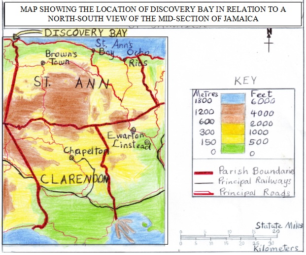
The first map should show the general location of the study area, that is, the region in the country where the study is located. This map should show features close to the study area. This map be a parish map showing the general location of the study site. This is called the location map.
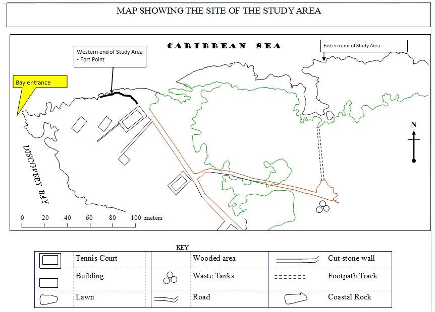
The second map, the site map, shows the area covered by the study in more detail. This map is usually drawn from field observation.
Make sure that both maps is clear and neat and and have a border, a scale, a north point, a key and a caption/title. The use of appropriate colour and symbols. Both maps should be hand drawn.
Make sure that both maps is clear and neat and and have a border, a scale, a north point, a key and a caption/title. The use of appropriate colour and symbols. Both maps should be hand drawn.
